Rhovanion
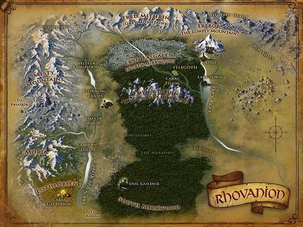
Rhovanion (Sindarin for Wilderland) is a Land in the north-east of Middle-earth. This land is comprised of many regions from Moria in the west, to the Iron Hills in the east and from Gundabad in the north, to Lothlórien in the south.
To reach Rhovanion, a character must pass through Moria, the Misty Mountains, or Angmar from the west or the Great River from the south.
For a summary of levels, see Regional Quests, a page which also indicates the main level of creatures and mobs.
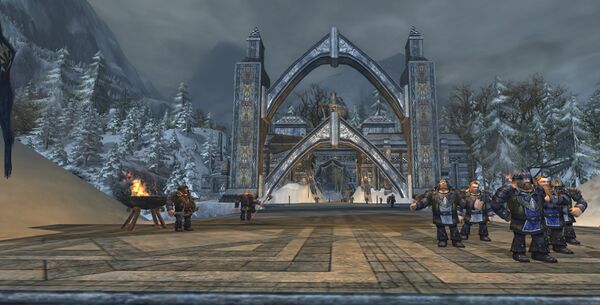
Azanulbizar, T.A. 2799 is a region found within the land of Rhovanion.
The landscape is set in the Dimrill Dale well before the War of the Ring, during the Sixth War of Dwarves and Orcs. The Haban'akkâ of Thráin, a great army of dwarves from all clans, is assembled under King Thráin of the Longbeards in vengeance for his father, Thrór, against Azog and the orcs of Moria.
- Level: 130
- Factions: The Haban'akkâ of Thráin
- Crafting: Minas Ithil (T13)
- Introduced: Update 30 - Blood of Azog, June 8th, 2021.
- Quest Pack:
 Quest Pack: Blood of Azog
- See Azanulbizar for more details
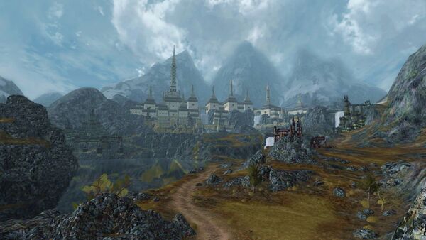
Elderslade is a region found within the land of Rhovanion.
- Level: 130
- Factions: March on Gundabad, The Gabil'akkâ
- Crafting: Minas Ithil (T13)
- Introduced: Update 28 - War of Three Peaks, October 20th, 2020.
- Quest Pack:
 Quest Pack: War of Three Peaks
- See Elderslade for more details
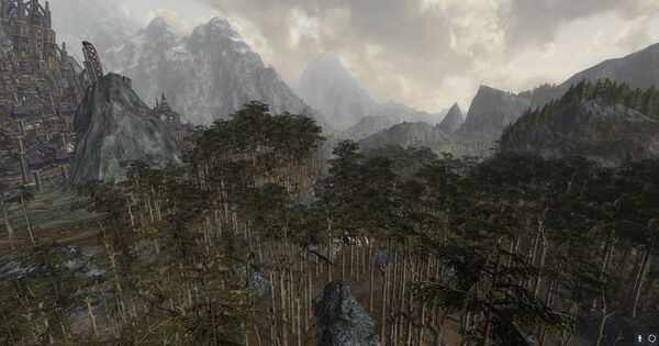
Ered Mithrin and Withered Heath is a region found within the land of Rhovanion. It is also known as the Dwarf-holds.
Ered Mithrin (Sindarin for Grey Mountains) is a large mountain range to the north of Rhovanion. Their western end connected to the Misty Mountains at of Mount Gundabad, an ancient Dwarven holy site and later the capital for the Orcs of the north.
The eastern end of the Grey Mountains was split into two chains, and in between lay the Withered Heath, where Dragons bred. After that was a wide hilly plain, beyond which lay the Iron Hills. Erebor, the Lonely Mountain, lay south of the Grey Mountains. [1]
- Level: 115 - 120
- Factions: Dwarves of Erebor and Grey Mountains Expedition
- Crafting: Ironfold (T12)
- Introduced: Update 23: Where Dragons Dwell, 9 October 2018
- Quest Pack:
 Quest Pack: Where Dragons Dwell
- See Ered Mithrin and Withered Heath for more details
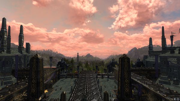
Eryn Lasgalen and the Dale-lands is a region found within the land of Rhovanion. It is also known as the Strongholds of the North as well as Northern Mirkwood, and encompasses the northern reaches of Mirkwood as well as the Dale-lands and the Lonely Mountain, Erebor.
- Level: 115
- Factions: Dwarves of Erebor, Elves of Felegoth, and Men of Dale
- Crafting: Doomfold T11
- Introduced: Update 22 - Legacy of the Necromancer, 6 March 2018
- Quest Pack:
 Legacy of the Necromancer
- See Eryn Lasgalen and the Dale-lands for more details
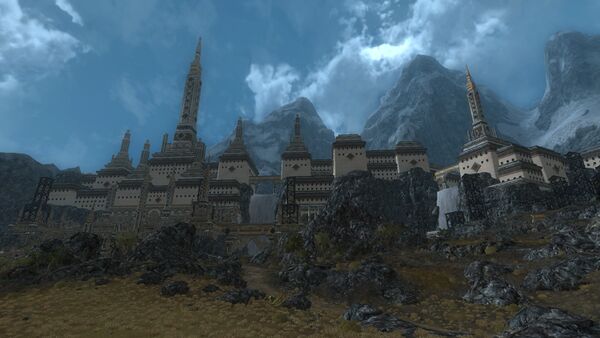
Gundabad is a region found within the land of Rhovanion.
This stronghold, also known as Mount Gundabad or Urbhármokh to the orcs, is the chief mountain of the Grey Mountains in the northwest of Rhovanion. The Gundabad expansion was preceded by the Azanulbizar, T.A. 2799 quest pack. From the northern part of the Vales of Anduin, Mount Gundabad appeared to be the northern endpoint of the Misty Mountains and the western endpoint of the Grey Mountains, although slightly separated from both ranges.[1] In actuality, the Misty Mountains continued past Mount Gundabad in a north-westerly direction (this extension was known as the Mountains of Angmar). In all maps the mountain was shown as having three conjoined peaks. Bordering Forochel (Forodwaith) to the north, the mountain undoubtedly had a cold climate.
- Level: 130 - 140
- Factions: Reclaimers of the Mountain-hold, Zhélruka Clan Allegiance
- Crafting: Gundabad (T14)
- Introduced: The Lord of the Rings Online: Fate of Gundabad, Update 31 - Wednesday November 10, 2021
- Questpack:
 Quest Pack: Fate of Gundabad
- See Gundabad for more details
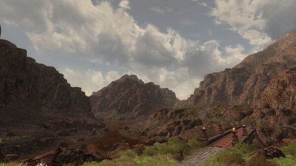
The Iron Hills is a region found within the land of Rhovanion.
This region is rich in minerals, most notably iron – whence came the name of the Hills. The Hills were originally a part of the massive Iron Mountains where Morgoth dwelt; other remains of this vanished range were the Mountains of Angmar and Ered Mithrin. The Iron Hills were also the source of the River Redwater, the reddish colour of which came from iron particles in its water. The river joins onto the River Running.
The Iron Hills were first settled by Farin Blackmattock of the Longbeards in the First Age. His keep, Járnfast was shattered in the breaking of Thangorodrim but was rebuilt, and stands still. The Iron Hills are the domain of the Lords of the Iron Hills. Náin the Slakeless, son of Dáin Ironfoot, holds the title now, at the end of the Third Age.
- Level: 116 - 120
- Factions: Dwarves of Erebor and Grey Mountains Expedition
- Crafting: Ironfold (T12)
- Introduced: Update 23: Where Dragons Dwell, 9 October 2018
- Free to VIP
- Quest Pack:
 Quest Pack: Where Dragons Dwell
- See Iron Hills for more details
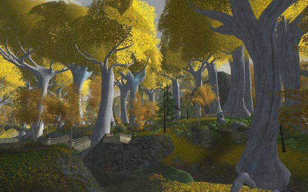
Lothlórien is a region found within the land of Rhovanion.
(Sindarin for Dream-flower) was a forest and Elven realm near the lower Misty Mountains. It was first settled by Nandorin Elves, but later populated by Ñoldor and Sindar under Celeborn of Doriath and Galadriel. It was located on the River Celebrant, southeast of Khazad-dûm, and was the only place where the golden Mallorn trees grew.
Galadriel's magic, later revealed as the power of her ring Nenya, enriched the land and made it a magic forest into which evil could not enter without difficulty. The only way that Lothlórien could have been conquered by the armies of Mordor is if Sauron had come there himself. [2]
WARNING: Some of the animals in this area are shown with a Protected tag under their name. DO NOT ATTACK THEM, if you kill one you will LOSE faction standing with Galadhrim
- Level: 56 - 60
- Factions: Galadhrim
- Crafting: Supreme (T6)
- Introduced:
 The Leaves of Lórien, February 27th, 2009
- See Lothlórien for more details
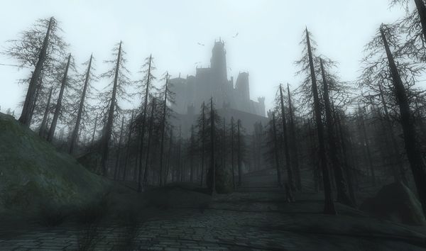
Mirkwood (Southern Mirkwood) is a region found within the land of Rhovanion.
(Sindarin for Wood of Greenleaves), also known as Eryn Lasgalen, encompasses a dense and heavy woodland from the eastern shores of the river Anduin to the dreaded fortress of Dol Guldur. Its natural land features included (in the northern part of the forest) the Mountains of Mirkwood, a sizable river referred to in Tolkien's map as the Forest River, that ran from the Grey Mountains down to Long Lake, and a smaller river that ran from the Mountains of Mirkwood to join with the Forest River west of the Elven-king's Halls.
- Note: Characters must complete the foreword quest chain for Vol. II. Book 9 to unlock the public instance of Mirkwood (your character's first experience within Mirkwood). You will enter the normal Mirkwood when you finish an instance concerning the assault on the gates leading to the Dourstocks.
- Level: 60 - 65
- Factions: Malledhrim
- Crafting: Supreme (T6)
- Introduced:
 The Lord of the Rings Online: Siege of Mirkwood, December 1st, 2009
- See Mirkwood for more details
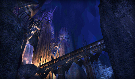
Moria (Sindarin for Black Abyss/Chasm/Pit) was the name given by the Eldar to the Dwarven kingdom which was properly called Khazad-dûm (Khuzdul for Dwarves' Delvings/Mansions). The Sindar adapted the Dwarvish name as Hadhodrond, and the Noldor as Cassarondo. Men called it the Dwarrowdelf (Archaic Westron for Dwarf-delving).
It is an enormous underground complex in north-western Middle-earth, comprising a vast network of tunnels, chambers, mines and huge halls or 'mansions', that ran under and ultimately through the Misty Mountains. There, for many thousands of years, lived the Dwarf clan known as the Longbeards in this city and one-time centre of dwarven industry. For over a thousand years of the Third Age it was widely known by the name Moria. It is located in Rhovanion, between Eregion and Lothlórien.
- Level: 50-60
- Factions: Iron Garrison Guards and Iron Garrison Miners
- Crafting: Supreme (T6)
- Introduced:
 The Lord of the Rings Online: Mines of Moria, November 18th, 2008
 - Area Restrictions: Horse and elk mounts cannot be summoned in this area. Only specially trained goat or boar mounts can be used.
- See Moria for more details
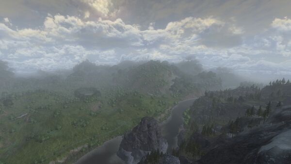
The Vales of Anduin is a region within northern Rhovanion, east of the Misty Mountains, south of the Floodfells, west of Eryn Lasgalen and Middle Mirkwood, and north of Lothlórien.
On the western eaves of Mirkwood, along the banks of Anduin to the north of the Old Forest Road reside the Beornings, a rustic tribe of Woodmen. All Beornings hail from these woods and dales surrounding the Anduin, from the shores near the Carrock up to the High Pass through the Misty Mountains. All Beorning players begin their journey in these Vales at Meadhollow.
- Level: 120
- Factions: Wilderfolk
- Crafting: Ironfold (T12)
- Introduced: Update 24: Vales of Anduin, 4 June 2019
- Quest Pack:
 The Vales of Anduin Quest Pack
- See Vales of Anduin for more details
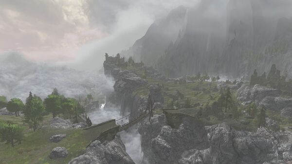
Wells of Langflood is a region found the land Rhovanion.
Langflood is the Rohirrim name for the river with the Sindarin name Anduin. Both names mean "Long River", reflecting the fact that it flows from this region and all the way south to the Bay of Belfalas. The Wells of Langflood lie west of Ered Mithrin and the Withered Heath, north of the Vales of Anduin, east of the Misty Mountains, and south of Elderslade and the Upper Anduin.
- Level: 130
- Factions: Protectors of Wilderland
- Crafting: Minas Ithil (T13)
- Introduced: Update 26: Mists of Wilderland, 23 April 2020
- Quest Pack:
 Mists of Wilderland Quest Pack
- See Wells of Langflood for more details
Navigation
| Regions within the Land of Rhovanion
| ||
|---|---|---|
| Azanulbizar, T.A. 2799 • Elderslade • Ered Mithrin and Withered Heath • Eryn Lasgalen and the Dale-lands • Gundabad • Iron Hills • Lothlórien • Mirkwood • Moria • Vales of Anduin • Wells of Langflood |
| Lands of Middle-earth
| ||
|---|---|---|
| Eriador • Gondor • Haradwaith • Mordor • Rhovanion • Rohan |
Category Overview
- ↑ J.R.R. Tolkien, The Hobbit, "Map of Wilderland"