Template talk:Tooltip Coords
Moria
Does this feature work with Moria Maps? MysterX 22:54, 20 April 2009 (UTC)
- Not yet as we need someone to set up the maps with the coordinates. I have no clue how it was done with the others. Rogue 23:52, 20 April 2009 (UTC)
- I am interested in this, too. But both Eleazaros and Fedaykinx stepped back from this project a few months ago. Should we tru to reach them online or through other means and see if they could, at least, share this information? --Ahrien 10:07, 23 April 2009 (UTC)
- BTW, I reached this js code that looks like what we need, but it's utterly gibberish to me :( --Ahrien 10:16, 23 April 2009 (UTC)
- I can see about talking to Fedaykin and learning how to do this exactly. I understand the concept, but I haven't reached the end game yet, my highest level is 54. I would need the right coordinates for each area. I'll give a progress report when I have more to report. Rogue 14:41, 23 April 2009 (UTC)
- Let's make sure when we get the information on how to add additional maps that we document it in the template :) Also I'm happy to help with coordinates. --Gaerlin 23:19, 30 May 2009 (UTC)
- Ok here's some information I got from Fedaykin about how to add new maps. First thing we need to do is gather the coordinates for each map. We will need the x and y min/max coordinates. Basically each corner of the map (as close as you can get). I put in Bree-land so you guys can get a feel for what we want. :) Once this is done then we are almost done!
- Well, it's about time we get this ironed out. I just uploaded all maps with a 450px width, and took all the min-max coords needed. It was actually pretty easy, since you can move the cursor to one corner of the map and it shows you the coordinates of that corner. 2 opposite corners for each map is enough to get all the data.
- I changed the format of the table below, since the data as it was requested could lead to confusion in some cases, like when we cross a 0 axis (from N to S, from W to E), so I thought having both corners would get us more data. I even put the corodinates using the Tooltip Coords Template, this way it is pretty easy for us to see if we have done this well, since when all it's done it should show us opposite corners.
- I tried to edit the .js to do this job myself, but it's protected and I cannot edit it, so I will fill the table and hope Rogue is still watching this discussion :)
- BTW, my suggestion would be, when using the Tooltip Coords template, to use the name of the map as it's shown in the map itself. So, for instance, The Water-works would be {{Tooltip Coords|The Water-works|0.0S|0.0W}}, not The Waterworks, Water Works, Water-Works, etc... --Ahrien 8:16, 13 November 2009 (UTC)
- Added the data for the last missing map, The Walls of Moria --Ahrien 11:38, 17 November 2009 (UTC)
- Ok here's some information I got from Fedaykin about how to add new maps. First thing we need to do is gather the coordinates for each map. We will need the x and y min/max coordinates. Basically each corner of the map (as close as you can get). I put in Bree-land so you guys can get a feel for what we want. :) Once this is done then we are almost done!
- Let's make sure when we get the information on how to add additional maps that we document it in the template :) Also I'm happy to help with coordinates. --Gaerlin 23:19, 30 May 2009 (UTC)
- I can see about talking to Fedaykin and learning how to do this exactly. I understand the concept, but I haven't reached the end game yet, my highest level is 54. I would need the right coordinates for each area. I'll give a progress report when I have more to report. Rogue 14:41, 23 April 2009 (UTC)
Add Map Coords here:
| Map Name | Upper Left Corner | Bottom Right Corner | Image |
|---|---|---|---|
| Eregion | [34.9S, 24.1W] | [57.8S, 6.4E] | 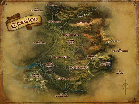
|
| The Walls of Moria | [48.5S, 9.0W] | [54.0S, 1.6W] | 
|
| Durin's Way | [2.1N, 114.1W] | [9.8S, 98.1W] | 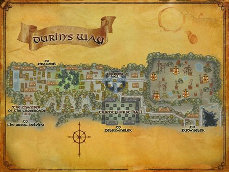
|
| Nud-melek | [3.9S, 105.3W] | [12.2S, 94.1W] | 
|
| The Flaming Deeps | [12.3S, 112.2W] | [18.0S, 104.6W] | 
|
| Foundations of Stone | [10.5S, 102.9W] | [16.4S, 95.0W] | 
|
| The Great Delving | [4.9S, 117.3W] | [10.3S, 110.1W] | 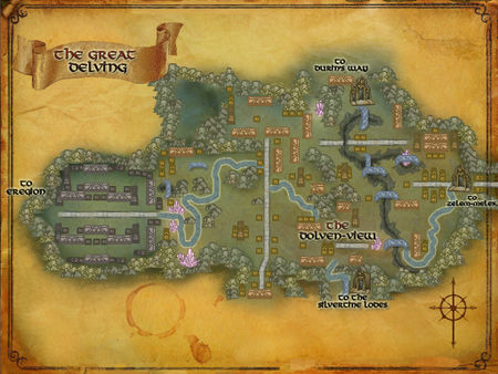
|
| The Silvertine Lodes | [8.5S, 116.2W] | [14.0S, 108.8W] | 
|
| Redhorn Lodes | [9.3S, 109.1W] | [16.3S, 99.8W] | 
|
| The Waterworks | [12.3S, 120.5W] | [22.5S, 106.8W] | 
|
| Zelem-melek | [3.8S, 114.0W] | [13.8S, 100.7W] | 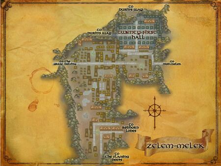
|
| Zirakzigil | [17.8N, 113.5W] | [11.5N, 105.0W] | 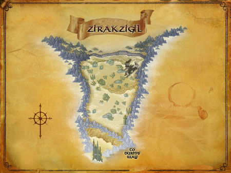
|
| Lothlórien | [4.5S, 82.1W] | [20.2S, 61.1W] | 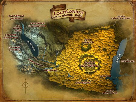
|
Thanks Ahrien for your contribution to the cause!!! I will work on adding this where it needs to go and see if we can't get it working!! Rogue 21:33, 13 November 2009 (UTC)
UPDATE
Ok, for the most part the addition of MoM maps and coords was successful and complete thanks to Ahrien and Fedaykin. The coordinates may (on some maps) be a bit off. We will continue to fine-tune them until they are exact. Thanks all for your patience. Rogue 01:30, 18 November 2009 (UTC)
- I noticed a few mistakes. It's easy to check if the job was well done, since the same corners coordinates in the table should show the tooltip map with the corner highlighted.
- Anyway, I think it's great news that we have this finally in place, and in time for the incoming SoM! All I have learned this last year from wikifying MoM I will put in practice with SoM :) -- Ahrien 9:37, 19 November 2009 (UTC)
- Errors I found:
Map Name Upper Left Corner Bottom Right Corner Notes Durin's Way [2.0N, 114.0W] [10.0S, 98.0W] Both corners are shown as upper right corner ¿? Nud-melek [4.0S, 105.2W] [12.4S, 94.0W] Bottom right corner is shown at the upper right corner The Great Delving [4.9S, 117.2W] [10.3S, 110.0W] Both corners are shown as upper right corner ¿? Redhorn Lodes [9.3S, 109.2W] [16.4S, 99.6W] Both corners are shown as upper right corner ¿? The Water-works [12.4S, 120.5W] [22.8S, 106.6W] Bottom right corner is shown at the upper right corner Zelem-melek [3.9S, 114.0W] [14.0S, 100.6W] Bottom right corner is shown at the upper right corner Zirakzigil [17.3N, 113.0W] [11.6N, 105.4W] Both corners have the upper/lower pos exchanged. Lothlórien [4.6S, 82.0W] [20.4S, 61.0W] Bottom right corner is shown at the upper right corner
- I showed fedaykin this post and we'll see what we can do. Not sure myself. Rogue 17:04, 19 November 2009 (UTC)
- Cool, I will investigate this later, it's quite likely that I messed up entering some of the coordinates, it was a quick job and I didn't double check to make sure they work. --Fedaykin 17:31, 19 November 2009 (UTC)
SoM maps: Caras Galadhon and Mirkwood
Well, here I am again with more maps and coordinates ;) This time it should be easier. No crossing a 0-axis, and only 2 new maps... And they're not even one month old yet! - Ahrien 8:38 AM, December 17th, 2009.
Add Map Coords here:
| Map Name | Upper Left | Bottom Right | Image |
|---|---|---|---|
| Caras Galadhon | [13.0S, 69.8W] | [17.0S, 64.6W] | 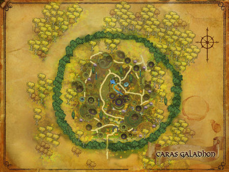
|
| Mirkwood | [5.7S, 62.7W] | [22.5S, 40.0W] | 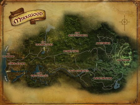
|
- Maps are a bit blurry to me, can we get these in better resolution??? Rogue 00:03, 22 December 2009 (UTC)
- I don't think I can get a better resolution ones. I don't know if it's 'cuz I play in 16:10 ratio, or my downsizing of the image, but this is the best I can get. I will upload the maps at full resolution and see if someone else can update the small map images. In the meantime, I guess slightly blurry images are better than no images? - Ahrien 7:09 AM, December 22nd, 2009.
- Sorry for the delay, I will take this on properly now. There were some mistakes I made in the min-max and some of the coordinates given were off as well. I should hopefully have it all fixed by tomorrow. --Fedaykin 22:46, 1 January 2010 (UTC)
- I don't think I can get a better resolution ones. I don't know if it's 'cuz I play in 16:10 ratio, or my downsizing of the image, but this is the best I can get. I will upload the maps at full resolution and see if someone else can update the small map images. In the meantime, I guess slightly blurry images are better than no images? - Ahrien 7:09 AM, December 22nd, 2009.
I NEED THE MIRKWOOD MAPS.. for each region inside Mirkwood!!! Rogue 19:01, 14 January 2010 (UTC)
- There's only one region =p and the coords should work now! --Fedaykin 19:25, 14 January 2010 (UTC)
Moria
Does this feature work with Moria Maps? MysterX 22:54, 20 April 2009 (UTC)
- Not yet as we need someone to set up the maps with the coordinates. I have no clue how it was done with the others. Rogue 23:52, 20 April 2009 (UTC)
- I am interested in this, too. But both Eleazaros and Fedaykinx stepped back from this project a few months ago. Should we tru to reach them online or through other means and see if they could, at least, share this information? --Ahrien 10:07, 23 April 2009 (UTC)
- BTW, I reached this js code that looks like what we need, but it's utterly gibberish to me :( --Ahrien 10:16, 23 April 2009 (UTC)
- I can see about talking to Fedaykin and learning how to do this exactly. I understand the concept, but I haven't reached the end game yet, my highest level is 54. I would need the right coordinates for each area. I'll give a progress report when I have more to report. Rogue 14:41, 23 April 2009 (UTC)
- Let's make sure when we get the information on how to add additional maps that we document it in the template :) Also I'm happy to help with coordinates. --Gaerlin 23:19, 30 May 2009 (UTC)
- Ok here's some information I got from Fedaykin about how to add new maps. First thing we need to do is gather the coordinates for each map. We will need the x and y min/max coordinates. Basically each corner of the map (as close as you can get). I put in Bree-land so you guys can get a feel for what we want. :) Once this is done then we are almost done!
- Well, it's about time we get this ironed out. I just uploaded all maps with a 450px width, and took all the min-max coords needed. It was actually pretty easy, since you can move the cursor to one corner of the map and it shows you the coordinates of that corner. 2 opposite corners for each map is enough to get all the data.
- I changed the format of the table below, since the data as it was requested could lead to confusion in some cases, like when we cross a 0 axis (from N to S, from W to E), so I thought having both corners would get us more data. I even put the corodinates using the Tooltip Coords Template, this way it is pretty easy for us to see if we have done this well, since when all it's done it should show us opposite corners.
- I tried to edit the .js to do this job myself, but it's protected and I cannot edit it, so I will fill the table and hope Rogue is still watching this discussion :)
- BTW, my suggestion would be, when using the Tooltip Coords template, to use the name of the map as it's shown in the map itself. So, for instance, The Water-works would be {{Tooltip Coords|The Water-works|0.0S|0.0W}}, not The Waterworks, Water Works, Water-Works, etc... --Ahrien 8:16, 13 November 2009 (UTC)
- Added the data for the last missing map, The Walls of Moria --Ahrien 11:38, 17 November 2009 (UTC)
- Ok here's some information I got from Fedaykin about how to add new maps. First thing we need to do is gather the coordinates for each map. We will need the x and y min/max coordinates. Basically each corner of the map (as close as you can get). I put in Bree-land so you guys can get a feel for what we want. :) Once this is done then we are almost done!
- Let's make sure when we get the information on how to add additional maps that we document it in the template :) Also I'm happy to help with coordinates. --Gaerlin 23:19, 30 May 2009 (UTC)
- I can see about talking to Fedaykin and learning how to do this exactly. I understand the concept, but I haven't reached the end game yet, my highest level is 54. I would need the right coordinates for each area. I'll give a progress report when I have more to report. Rogue 14:41, 23 April 2009 (UTC)
Add Map Coords here:
| Map Name | Upper Left Corner | Bottom Right Corner | Image |
|---|---|---|---|
| Eregion | [34.9S, 24.1W] | [57.8S, 6.4E] | 
|
| The Walls of Moria | [48.5S, 9.0W] | [54.0S, 1.6W] | 
|
| Durin's Way | [2.1N, 114.1W] | [9.8S, 98.1W] | 
|
| Nud-melek | [3.9S, 105.3W] | [12.2S, 94.1W] | 
|
| Flaming Deeps | [12.3S, 112.2W] | [18.0S, 104.6W] | 
|
| Foundations of Stone | [10.5S, 102.9W] | [16.4S, 95.0W] | 
|
| The Great Delving | [4.9S, 117.3W] | [10.3S, 110.1W] | 
|
| The Silvertine Lodes | [8.5S, 116.2W] | [14.0S, 108.8W] | 
|
| Redhorn Lodes | [9.3S, 109.1W] | [16.3S, 99.8W] | 
|
| The Water-works | [12.3S, 120.5W] | [22.5S, 106.8W] | 
|
| Zelem-melek | [3.8S, 114.0W] | [13.8S, 100.7W] | 
|
| Zirakzigil | [17.8N, 113.5W] | [11.5N, 105.0W] | 
|
| Lothlórien | [4.5S, 82.1W] | [20.2S, 61.1W] | 
|
Thanks Ahrien for your contribution to the cause!!! I will work on adding this where it needs to go and see if we can't get it working!! Rogue 21:33, 13 November 2009 (UTC)
UPDATE
Ok, for the most part the addition of MoM maps and coords was successful and complete thanks to Ahrien and Fedaykin. The coordinates may (on some maps) be a bit off. We will continue to fine-tune them until they are exact. Thanks all for your patience. Rogue 01:30, 18 November 2009 (UTC)
- I noticed a few mistakes. It's easy to check if the job was well done, since the same corners coordinates in the table should show the tooltip map with the corner highlighted.
- Anyway, I think it's great news that we have this finally in place, and in time for the incoming SoM! All I have learned this last year from wikifying MoM I will put in practice with SoM :) -- Ahrien 9:37, 19 November 2009 (UTC)
- Errors I found:
Map Name Upper Left Corner Bottom Right Corner Notes Durin's Way [2.0N, 114.0W] [10.0S, 98.0W] Both corners are shown as upper right corner ¿? Nud-melek [4.0S, 105.2W] [12.4S, 94.0W] Bottom right corner is shown at the upper right corner The Great Delving [4.9S, 117.2W] [10.3S, 110.0W] Both corners are shown as upper right corner ¿? Redhorn Lodes [9.3S, 109.2W] [16.4S, 99.6W] Both corners are shown as upper right corner ¿? The Water-works [12.4S, 120.5W] [22.8S, 106.6W] Bottom right corner is shown at the upper right corner Zelem-melek [3.9S, 114.0W] [14.0S, 100.6W] Bottom right corner is shown at the upper right corner Zirakzigil [17.3N, 113.0W] [11.6N, 105.4W] Both corners have the upper/lower pos exchanged. Lothlórien [4.6S, 82.0W] [20.4S, 61.0W] Bottom right corner is shown at the upper right corner
- I showed fedaykin this post and we'll see what we can do. Not sure myself. Rogue 17:04, 19 November 2009 (UTC)
- Cool, I will investigate this later, it's quite likely that I messed up entering some of the coordinates, it was a quick job and I didn't double check to make sure they work. --Fedaykin 17:31, 19 November 2009 (UTC)
SoM maps: Caras Galadhon and Mirkwood
Well, here I am again with more maps and coordinates ;) This time it should be easier. No crossing a 0-axis, and only 2 new maps... And they're not even one month old yet! - Ahrien 8:38 AM, December 17th, 2009.
Enedwaith Map
Add Map Coords here:
| Map Name | Upper Left | Bottom Right | Image |
|---|---|---|---|
| Enedwaith | [53.6S, 31.4W] | [76.3S, 0.9W] | 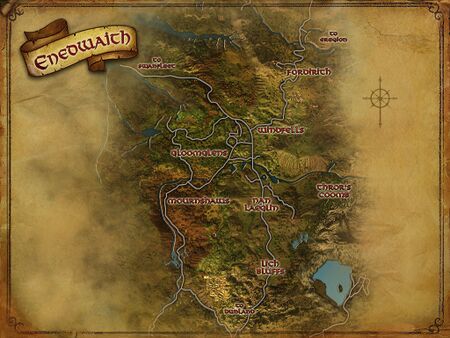
|
NOTE: We need someone to get a nice screenshot of a clean map and size it to specifications: 450 x ###... Once this is in place we can add it to the template. Rogue 20:07, 22 September 2010 (EDT)
- Hopefully the map I just uploaded will suffice. It's 450x281, which is the size of many of the Moria maps. Zagyg 10:18, 23 September 2010 (EDT)
- Yep, that's perfect. I'll make sure this gets in place real soon so we have the tooltip coords working. Rogue 11:53, 23 September 2010 (EDT)
Frostbluff Map
Add Map Coords here:
| Map Name | Upper Left | Bottom Right | Image |
|---|---|---|---|
| Frostbluff | [14.4N, 96.4W] | [10.8N, 91.6W] | 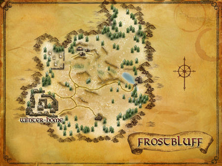
|
NOTE: We need the coordinates, after that we can add the map to the template -- Tiberivs 07:24, 28 December 2010 (EST)
- OK, added coords, seems to I can edit the js-code, so please can someone do? -- Tiberivs 03:40, 29 December 2010 (EST)
- Added to js-template --Tiberivs 13:24, 23 January 2011 (EST)
Barrow downs Map
Add Map Coords here:
| Map Name | Upper Left | Bottom Right | Image |
|---|---|---|---|
| Northern Barrow-downs | [33.5S, 52.5W] | [29.9S, 57.3W] | 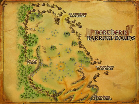
|
| Southern Barrow-downs | [37.1S, 51.9W] | [32.7S, 57.8W] | 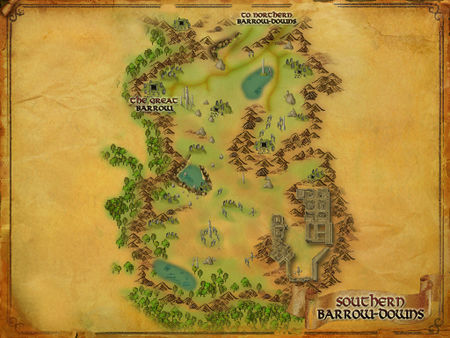
|
Added both maps to the js-template, just use Northern Barrow-downs/Northern Barrows or Southern Barrow-downs/Southern Barrows if you want to add coordinates in those regions (I'm planning to fix al excisting places/npcs). --Tiberivs 13:26, 23 January 2011 (EST)
Thorin's Hall Interior Map
Add Map Coords here:
| Map Name | Upper Left | Bottom Right | Image |
|---|---|---|---|
| Thorin's Hall Interior | [78N, 46E] | [75N, 49E] | removed |
- Added map for "Thorin's Hall Interior", will determine coordinates. --Zimoon 10:34, 8 September 2011 (EDT)
- Hovering over the icons at the in-game map reveals that the "inhabited" area goes from left->right 46E->49E and from top->down 78N->75N. I believe we have to fiddle with the math to stretch that onto the upper/left -> lower/right corners of the map, and then prolly test it too. It would be cool though, to prove those wrong that says it cannot be done ;)
- My math gives leftmost 45.5E and rightmost 49.5E, topmost 78.1N and bottommost 74.9N
- Give or take because with the scale of the map and the coarse coordinates from the hover-over-icons there is quite some error-margins :( --Zimoon 10:46, 8 September 2011 (EDT)
- Hovering over the icons at the in-game map reveals that the "inhabited" area goes from left->right 46E->49E and from top->down 78N->75N. I believe we have to fiddle with the math to stretch that onto the upper/left -> lower/right corners of the map, and then prolly test it too. It would be cool though, to prove those wrong that says it cannot be done ;)
Rise of Isengard update
| Map Name | Upper Left | Bottom Right | Image |
|---|---|---|---|
| Dunland | [70.8S, 28.6W] | [90.9S, 1.9W] | 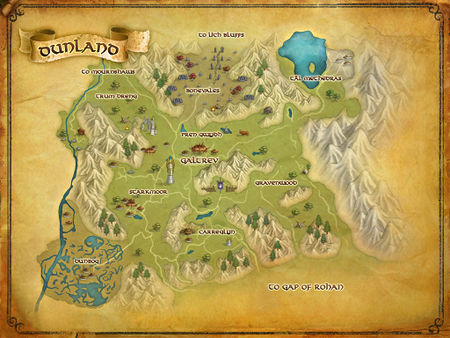
|
| Dunlending map | [70.5S, 28.5W] | [98.0S, 4.2E] | 
|
| Gap of Rohan | [80.4S, 20.8W] | [95.3S, 0.9W] | 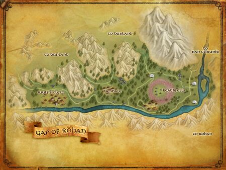
|
| Nan Curunír | [76.1S, 9.5W] | [86.3S, 4.1E] | 
|
| Galtrev | [78.9S, 18.4W] | [81.6S, 14.8W] | 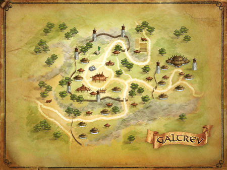
|
| Isengard | [76.3S, 6.3W] | [82.1S, 1.4E] | 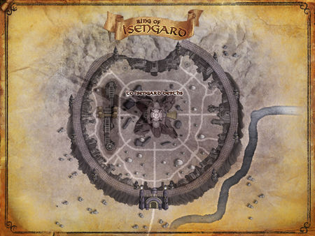
|
| Isengard Depths | [76.8S, 31.3E] | [81.5S, 37.5E] | 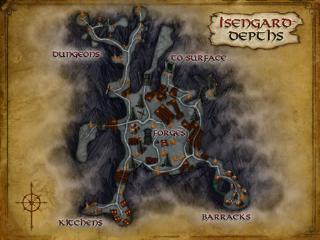
|
These first three maps need to be added to the template. I'm not sure if Nan Curunír needs to be Nan Curunir (without the non-standard i), but if it can be both ways like with Lothlórien, that'd be even better. The other three maps would be good to include but aren't necessary as I don't know if there are too many cases of inset maps being used, but they're here if we decide to use them. Neum (talk) 19:46, 28 September 2011 (EDT)
- Thanks for the coordinates, I added them for all maps although they need some tweaking. Just for your information, we got a new coord tooltip which doesn't require to upload the 450px files anymore. :) --EoD (talk) 20:26, 7 October 2011 (EDT)
- If you want to adjust the coordinates go to User:Eleazaros/coords.js and read the "HOWTO add/change coordinates" section. Also try to add examples coorindates to the example page as soon as you added new coordinates. --EoD (talk) 13:22, 8 October 2011 (EDT)
- I think I Just found the error on the Dunland map... the lower right coordinate is 1.9 W not 19.9E.
- Gap of Rohan has the same problem ... should be 0.9W, not .9E -- other maps (above) are all ok. Wm Magill - Valamar - OTG/OTC (talk) 15:48, 8 October 2011 (EDT)
- I find that there is no swirling marker for quests at Isengard, example Quest:Trivial Business, and I wonder about the reason. Are the coordinates wrong? Should the JS page be updated/corrected? What can we do? -- Zimoon 02:36, 30 May 2012 (EDT)
- There are two sets of Isengard surface and Isengard depths maps. Both have nearly identical appearance, as far as I recall. One has N/S coordinates containing N while the other has N/S coordinates containing S. The map with N/S of N is where you are when you are a captive, and does not correspond to the world map coordinates of Isengard. The map with N/S of S is the one you can reach from Nan Curunír, and has coordinates that put it near the correct location on the world map. With the Isengard Depths, when you are in the Forges of Isengard instance, there are coordinates below the radar, and the game shows the Isengard Depths map, but in-game the swirly cursor does not show on the map. I think our maps are set up to handle the non-prisoner and non-instance cases. A complementaty problem is that every location that appears on both maps needs dual coordinates. I'd like to see it resolved, as I like to see accurate maps outside the game.
- BTW, the JS page coordinates are correct, for the map it is showing. Problems is there are two maps for what appears to be the same area, but at different quest states.
- RingTailCat (talk) 06:32, 30 May 2012 (EDT)
- I guessed it was something like that, but I have no idea on how to solve it. -- Zimoon 12:50, 30 May 2012 (EDT)
New code
I added a new code for fetching maps here. Please test it and tell me if you find any bugs. Will port that to lotro-wiki this evening. --EoD (talk) 05:57, 7 October 2011 (EDT)
Bug
Regarding The Shire versus Shire. Change from upper line to lower line at an obvious place:
       switch (zone) {
       switch (specialImageTitle) {
--Zimoon 15:21, 8 October 2011 (EDT)
The Shire
I am not allowed to edit Elea's JS page but coords for The Shire is upper/left 22.9S/80.9W and lower/right 38.8S/59.8W.
The tooltip is lightly off but I notice that one factor is the size of the animated-image itself, it is never subtracted from the relative position generated by our code. The code itself does not lend us much leeway either as the subtraction should be absolute but we compute and use a relative value. Of course it is possible to find the exact formula, I need to think about that later on.
Another possible cause for error is the screenshot itself. If it is not fullscreen but somewhat truncated in one end or the other, or all, then we must find the corners for that map, and coords from our game is useless. In that case it is easier to replace the map so that we know it works. I repeat, this is a possible cause of error, not an accusation anyone exists. --Zimoon 17:43, 8 October 2011 (EDT)
Weird Font Size
I noticed, while using my workplace laptop that the tooltip coords are rendered a bit weird. This is not the case at my home-workstation (unless it changed very recently). This is also visible at my Linux workstation, even more since the common column width of 100 is not enough but there is a line-break if e.g. the W-coordinate is 3-digits and a fraction.
- Example
The example is viewed at Win7 + FireFox 8.0 -- nothing extra-fancy that I know of.
My Linux workstation is FC 15 + FireFox 6.0
As seen, the coords are actually BIGGER than all other text, though somewhat elevated as they should be. At a guess there is something with the CSS class "coordslink" that does not play well with some browsers, and there my guess borders to the limits of my skills on this matter.
The same page renders just fine using MS Explorer 8.0.
Now I need to rush home and see what combination I have there but at a guess it is Win7+FF8.0.
Zimoon 10:52, 27 December 2011 (EST)
PS: I realize, after counting pixels, that the numbers are exactly the same height as capitals, just that they look bigger. However, using MSIE they are smaller which is the impression I always have had. Zimoon 10:58, 27 December 2011 (EST)
- Hmmm, I believe it might have to do with a browser setting: minimum font-size. I think I have that one set at work (probably 10) but it is not set at home.
- Is this a user error at my side then? I would say no. Actually it is not a good thing to use fixed widths for any HTML tables as it gives weird effects for all users that for any reason must increase font-size so that it blows up the column widths. I guess the proper way would be to use column-widths relative the actual font-size (the one that the user sets in her browser, if she does), but whether that is possible or not is beyond my web-skills. In summation: as soon as a user must increase what we youngsters with fresh eyes decide is a good looking font size then it breaks what looked so good to begin with :P
But let us have that discussion elsewhere ;) Zimoon 11:57, 27 December 2011 (EST)
Tooltip-coords Behave Weird
Tooltip-coords behave weird in a particular use case: when used at pages that have the same name as the map has.
- Example: Ered Luin
At first I could not think of a reason why the tooltips were rendered in bold black and they were not clickable as they are at all other pages. Comparing with the Shire--for some random reason--I found the same issue. And, loo and behold, at Thorin's Gate. However, at Ered Luin suddenly some tooltips looked the usual way (see under Points of Interest). What was the difference? Some links use "Thorin's Gate" for the map, and they behave normally, and those that use the "Ered Luin" do not.
This is an effect of how the Wiki engine works: if a link for XYZ is rendered at page XYZ it is replaced with bold text.
Today this anomaly breaks normal behaviour on all region pages and on all pages who are using finer-scale maps, such as those in Bree, Moria, Dunland, Northern and Southern Barrow-downs, etc. The hover-over map is displayed but the link is not a link, hence useless.
Is there a way to work around this? If not I suggest that we add support to the template so if the name for the map includes " map" the template will handle that case, e.g. the following would behave the same way:
{{Tooltip Coords|Ered Luin map|23.0S|97.2W}}
{{Tooltip Coords|Ered Luin|23.0S|97.2W}}
Then the link would not read the same as the page name and it would behave normally; we would have to walk over all pages which have same name as the template is using and add " map" (not so many though). Or is there some simpler way?
Zimoon 08:00, 28 December 2011 (EST)
- Good catch. I have been noticing that on the Galtrev page. It is annoying to see. A fix would be very welcome! RingTailCat (talk) 12:39, 28 December 2011 (EST)
- I can see how it'd be confusing/annoying to have black font showing up instead of the blue link we're accustomed to, but I'm not sure how making the coords bit resemble a link would help: If you're on the Ered Luin page, it doesn't make much sense to click a link to take you to ... the Ered Luin page. It would make sense to make it look like a link in order to indicate that it's an interactive part of the page (for users that don't know to hover over the coords and get a pop-up map) but if it looks like a link, then users will expect it to "take" them somewhere, right?
In short: What should "normal" functioning look like to you guys? Sethladan 23:14, 28 December 2011 (EST)
- I can see how it'd be confusing/annoying to have black font showing up instead of the blue link we're accustomed to, but I'm not sure how making the coords bit resemble a link would help: If you're on the Ered Luin page, it doesn't make much sense to click a link to take you to ... the Ered Luin page. It would make sense to make it look like a link in order to indicate that it's an interactive part of the page (for users that don't know to hover over the coords and get a pop-up map) but if it looks like a link, then users will expect it to "take" them somewhere, right?
- Uhhhmm, rii-ii-ght. I concur and believe I was thinking about how often I have clicked these links, usually to get to the map, but that is correct, I went via a page first. And at a region page the map is there. Probably also at the other pages I mentioned. Then the priority is downed from "useless" to "unattractive" .. the font is not only black, it is bold too :P
- What would make sense, only in this case maybe, is to make the link take you directly to the map but ...
- Zimoon 02:47, 29 December 2011 (EST)
- Zimoon's idea makes sense - having the link point directly to the maps section of a page. This could be done either for all Tooltip Coords or just when pagename == the map name parameter. When linking to a section, the link remains blue and active instead of black and bolded: Template talk:Tooltip Coords vs. Template talk:Tooltip Coords#Tooltip-coords Behave Weird. Another option might be something like Template talk:Tooltip Coords#top, which will keep the link blue and active, but just send the user back to the top of the page. The question is whether either of these is a desirable effect, and I'll let others decide that. Sethladan 11:15, 29 December 2011 (EST)
- I would also want to hear from others but my personal use has 90% been a quick jump to a bigger map :)
- That the links in black and bold "are intentionally" I doubt, then you need to explain why you decided for that scheme and elaborate on why it is a good decision. Otherwise I'd dare say that my explanation in the first post is more correct, this is a weird side effect of how the wiki-engine works and it is not "intentional" ;)
Zimoon 02:13, 30 December 2011 (EST)
- I wouldn't call it a weird side-effect at all, heh; it seems to be a design choice (by MediaWiki developers, not by us). I mentioned usage reasons above about links being expected to "go" somewhere, and it also lets you link back to a page (without using an includeonly section) when you transclude. That aside...
Zimoon: When you say you use it as a quick jump to a bigger map, do you mean that you (just your personal use) want to go to the image file? or the map on the region page? Sethladan 11:26, 30 December 2011 (EST)
- I wouldn't call it a weird side-effect at all, heh; it seems to be a design choice (by MediaWiki developers, not by us). I mentioned usage reasons above about links being expected to "go" somewhere, and it also lets you link back to a page (without using an includeonly section) when you transclude. That aside...
- Let us not quarrel over words, in this case the result is ugly and the "link" is dead. Remember that I have all the time blamed media-wiki, not anybody of us. But we can possibly do something about it, finding a "workaround" (that word was used in the very first post). If we want to. Do we? The reasons would be to remove a stain from our shiny site, and to make the link useful.
- To the image file. Even if maps in Lotro are cartoony and not too detailed they may give some information. And when the hover-over map is too a small scale I use the bigger one. So usually that will be a 3-click-procedure: to some page, if it contains a map I click the map, otherwise I need an extra step. Of course I can find some other roundabout that takes me to the map, no problem.
- From my point of view, this is now about looks, to not stain our jewel. If we when fixing that vanity issue at the same time makes the "link" useful it is great. Probably re-routing it to map when page equals coords-map-name makes most sense. (It's funny, until now I have not thought of the name in the coords as anything else but map-name even though I knew it took me to a location page. I guess it is because it so strongly decides which map is displayed in the hover-over.)
Zimoon 12:45, 30 December 2011 (EST)
Shores of the Great River
| Map Name | Upper Left | Bottom Right | Image |
|---|---|---|---|
| The Pit of Iron | [52.3N, 94.4W] | [49.3N, 90.4W] | 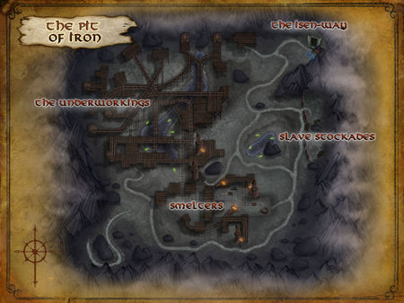
|
| The Great River | [17.2S, 79.3W] | [37.6S, 46.9W] | 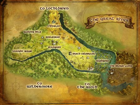
|
| Stangard | [24.9S, 65.1W] | [27.1S, 62.2W] | 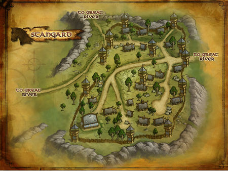
|
- As of now, the tooltips in the Great River region display the map without the pointer. This can be corrected when U6 is release and we get final map images and can record coordinates at map corner points. RingTailCat (talk) 21:45, 9 March 2012 (EST)
- There is a problem with the File:Stangard map.jpg which causes the javascript to fail to load the image. I was not able to determine what the problem was. I'm hoping that a new version captured Monday will resolve the problem. We also need coordinates for the File:Annúminas map.jpg. And maybe for the new Archet map. RingTailCat (talk) 05:54, 10 March 2012 (EST)
Here's The coords from in-game. I added them to the tooltips -- is anything else needed? Note: the Map pull down calls it the "Iron Pit". Also, uploaded new maps after the patch -- Stangard Map and The Great River Map -- Stangard especially, needs the "Map" in the name according to the discussion about the "bold" vs "blue" values. BTW, I don't think I ever realized the map coordinates were "clickable," but I too frequently go to the map image because the tooltop map is just so tiny. Now if we could just get the BIG image map with the "Swirlie," THAT would be useful!
- Wm Magill - Valamar - OTG/OTC (talk) 15:18, 12 March 2012 (EDT)
- The map filename must end with "_map.jpg" (lowercase, and underscore required). The leading part of the name is exactly what appears in the Template:Tooltip Coords call, with an leading 'The ' stripped off. (This is happening at a low level in the javascript code, and not subject to correction using redirects.) It is possible that the name of the map article page (File:Stangard map.jpg) does not match the internal or hidden name of the actual image that gets referenced. A complication is that articles and images are not truely and completely deleted when "we" delete them from the wiki. They are still there on the server, so I understand, but unavailable from wiki. This may interfere with trying to load new versions of the image with the correct name. RingTailCat (talk) 20:22, 12 March 2012 (EDT)
Swirlie
Do you people think this "swirile" is really practical for coordinate tooltip? I'd look for something more noticeable, like a big red dot. Animated one, if you like. ENDrain (talk) 14:05, 6 September 2015 (UTC)
- That is an interesting question -- however, the corollary is -- what alternative exists? Personally, I am unaware of the technology behind the "swirlie" so I don't have an option on how easily it would be to replace it. I know that it is related to Javascript but beyond that I don't know if it is simply an animated Gif and by replacing the "swirlie" with say, a "Pulsing Red Dot" is a trivial change or a very complex one.
- The other editors who I would go to for advice have not been logged in since June. I don't know if any of the others who are still active have any knowledge or opinion on the matter.
- Wm Magill - Valamar - OTG/OTC - talk 16:51, 6 September 2015 (UTC)
- In User:Eleazaros/coords.js - Collapsed below... The line src="..."
function showCoordsTip(zoneImage) {
  var tip = document.getElementById('coordstfb');
  tooltip = ttHTMLStart + '<div class="ZoneMap" style="position:relative;width:'+mapsize+'px;">';
  tooltip = tooltip + '<img width="'+mapsize+'px" src="' + zoneImage + '" alt="">';
  if (yPos >= 0 && xPos >= 0) {
  tooltip = tooltip + '<img style="position:absolute; height:8px; width:8px; left:'+yPos+'%; top:'+xPos+'%; margin:-4px" src="https://lotro-wiki.com/images/e/e5/Coord_mark.gif">';
  }
  tooltip = tooltip + '</div></div>';
  tip.innerHTML = tooltip;
  tip.style.position = "absolute";
  tip.style.visibility = "hidden";
  tip.style.display = "block";
  tip.style.zIndex = "999";
  moveCoordsTip();
  tip.style.visibility = "visible";
}
- This is the reference to the 'swirlie' that could be changed to any gif, png... extension that could be wanted. But that said, I don't mind it personally.
- But I wouldn't mind the addition of multiple points on the map. I think it could be done, but it would probably involve either rewriting the script itself to accommodate multiple XY references, or just adding in a handler for this in the current script. I'm not big with coding/scripting and was never more than an enthusiast so take what I say with a grain of salt.
- This is also not to mention it would probably have to involve creating or editing templates to have multiple XY fields (X1,Y1,X2,Y2,X3,Y3...) similar to the quest template which has the x1y1x2y2 for begin and end quest coords.
- Ketrez (talk) 01:49, 11 September 2015 (UTC)
- This template is probably used on more pages than any other.
- Keep in mind that any development/testing on this template needs to be done over on the test-wiki. (I'm assuming that it is still functional.)
- Alternatively, a completely new set of components could be created maybe call it "multi-coord" or something.
- Wm Magill - Valamar - OTG/OTC - talk 12:35, 11 September 2015 (UTC)
- It was just a thought, I don't think I'd be able to code it either. It'd be useful/easier for making maps for Free Range chicken play, deed locations, my scholar artifact maps, quest item locations, etc. Anywhere from a few to many coordinate pairs. -Laineth (talk) 04:08, 17 September 2015 (UTC)
Make maps bigger?
Is there any way we could make the popup maps generated by this template bigger? I find them to be tiny when viewed on a monitor with a decent resolution. I think they could easily be twice as big and still fit, and be much more readable as well. --Gaerlin (talk) 19:41, 25 August 2017 (UTC)
- I assume it is a function of the Java Script code. The original script dates back to 2008 -- when monitors were only 9 inch diagonals! (I use a 27inch monitor myself now.)
- Here is all the info about the maps. I don't really do Javascript (I'm an old FORTRAN II and COBOL programmer), but apparently the variable "mapsize = "450";" is the particular thing - although I don't know what units or what changing it would accomplish or break! (There are 4 refernces to that variable on thepage.)
- There is a "function showCoordsTip(zoneImage)" at the end of the file, which implies (to me) that the map size is 450px -- but that is clearly not the case as a 400px image is much larger than the pop-ups. Although I note that this uses "Img" rather than "File" so It will take some syntax chasing on MediaWiki to find out the difference between the two - especicall since I note some specifig IE code.
- Keep in mind that any script chnges will impact the ENTIRE wiki! We used to have a test wiki, but since it got vandalized several times, and nobody was really using it anymore, it got dropped.
for updating maps
- User:Eleazaros/coords.js -- Javascript code page for adding map coordinates
- User_talk:Eleazaros/coords.js -- Test page for Javascript code page for adding map coordinates
- Template:Tooltip Coords -
- Template:Tooltip Coords/doc -- add map referenceto appropriate region
- Maps -- add map to appropriate region
- Category: Regional Maps -- add map to appropriate region
- Good luck! Wm Magill - Valamar - OTG/OTC - talk 20:39, 25 August 2017 (UTC)
- OK I changed the template to double the size of the map to 900px, doubled the size of the swirlie icon, and changed positioning so that it always pops up in the center of the screen. Let me know if that causes any issues. --Gaerlin (talk) 17:17, 26 August 2017 (UTC)
- I got some feedback from my kinmates that the new size may be a bit too big, so I'm going to work on making the map size dynamic based on the size of the browser window. Also the experience with the map isn't great if your mouse cursor happens to be under the map when it pops up, so I will see if I can fix that too. Still working on it... --Gaerlin (talk) 04:13, 27 August 2017 (UTC)
- Just noticed... use the page Treasure of Udûn (Deed) -- maps are centered horizontally, but vertically, they are appearing below the screen. -- i.e. the mouse cursor appears to be locating in the upper left quadrant of the map.
- Wm Magill - Valamar - OTG/OTC - talk 15:56, 30 August 2017 (UTC)
- Strange, I'm not seeing that behavior. For me, the map is appearing centered horizontally right above my mouse cursor, unless the link is too high on the page, in which case it's appearing right below the mouse cursor. It's not showing off the screen however. What resolution are you running and is your browser window maximized or, if not, approximately how big is it compared to your whole screen (i.e. half, a third, etc.)? --Gaerlin (talk) 16:52, 30 August 2017 (UTC)
Ring of Isengard not working
I'm trying to add some tooltips for the NPCs you have to fight in Quest:Their Best Interests and they're not working: you get the map popping up but no swirly. I checked the master copy at User_talk:Eleazaros/coords.js#(2011 Oct) Rise of Isengard (ROI) - Volume III: Book 4 (Expansion) and that isn't working either. I spot-checked some others and it's not the only one acting screwy: the entry on the Dunlending map for "The middle of the circle on the roof of the Isengard tower [76.9S, 2.0W]" is the only one which actually shows up and it's way off. Has something been adjusted recently which broke some of the tooltips? TIA HAND —NotACat (talk) 11:20, 21 August 2018 (UTC)
Simplified the source code
Any non-expert should be able to add a new map to the javascript file now. Thurallor (talk) 06:55, 13 June 2019 (UTC)
Update 26 maps and fix for Eryn Lasgalen
Here are the coordinates for the three new maps that came with Update 26 and a fix for Eryn Lasgalen (the coordinates were strangely off on that one).
MapData["Eastfold Hills Homesteads"] = { top:-62.0, left:-73.5, bottom:-68.4, right: -65.0 };
MapData["Kingstead Meadows Homesteads"] = { top:-54.8, left:-73.3, bottom:-60.4, right:-65.9 };
MapData["Wells of Langflood"] = { top:34.2, left:-75.2, bottom:13.8, right:-47.9 };
MapData["Eryn Lasgalen"] = { top:37.4, left:-56.6, bottom:5.4, right:-13.8 };
Could someone with the proper privileges make the change on User:Eleazaros/coords.js? Thanks in advance! Dadwhereismom (talk) 18:40, 23 April 2020 (UTC)
Off-map coordinates
Some pages need show map markers off-map, e.g. Guard Edrud. Currently, the only option to do it is to disable coordinates verification for entire page using {{Tooltip Coords/skip thorough coords checking}}.
I propose to allow optional 'off-map' attribute after coordinate, so '30.3W' will become '30.3W off-map' if it has to be rendered outside of the map borders. Tooltip Coords template will expand valid map boundaries for some reasonable amount (like 1/3 of width/height) for such coordinates instead of completely disabling the check. As 'off-map' attribute is a part of coordinate, it can be safely used as a parameter to any template that shows map tooltip. Gloomli (talk) 16:15, 6 December 2024 (UTC)