Category:Regional Maps
Jump to navigation
Jump to search
Some discussion on the overall Mapping system in LOTRO
Details for updating maps on the Wiki
- User:Eleazaros/coords.js -- Javascript code page for adding map coordinates
- User_talk:Eleazaros/coords.js -- Test page for Javascript code page for adding map coordinates
- Template:Tooltip Coords/doc -- add map reference to appropriate region
- Maps -- add map to appropriate region
- Category: Regional Maps -- add map to appropriate region
Garan's Terrain Maps on lotrointerface
Garan
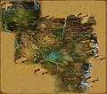
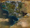
- There are two distinct co-ordinate origins in use for exterior areas. The first in Eriador was used until the world builders, sometime while developing Moria, realized their chosen origin would eventually cause problems with overflows as it was too far west and north (moria's entrance was near the 0 mark for E/W and quite a ways south) and there was a tremendous amount of area to the south and east. So when Moria was released it was the first part of the map to use the new co-ordinate origin which was further south and east (making coordinates further north and west) and is now used for all of Rhovanion, Gondor and Mordor regions. This means there is some overlap where co-ordinates are not unique between Eriador and Rhovanion/Gondor/Mordor so a co-ordinate clue without a region might point to two possible map locatons.
- For instance, Bag End is at 29.4S, 71.4W in Eriador but those same co-ordinates are also in Limlight Gorge, Great River in Rhovanion. So just saying 29.4S, 71.4W is not sufficient to determine which location is correct. Of course, there are only two co-ordinate systems in use so it's not too hard to test both locations.
- Unfortunately, when they were concentrating on SoA, they didn't think it through far enough, the world that they were concerned with ended in the Trollshaws since SoA was focused on Angmar. They had no idea if the game would survive long enough to have any additional content. By the time they were working on Moria and considered the possibility that the game would survive long enough to need Mordor, they realized their mistake but it was too late to go back and rework all of the co-ordinates for everything in the game. Too many things depend on the co-ordinates, such as quest text, events triggering, etc. added to the fact that all of the third party sites referenced the existing co-ordinates, so they felt it was best not to try to fix the existing world and to just use Moria as a buffer to the new co-ordinate system. It works fairly well since the real underlying co-ordinates of each region are based on a whole different system which is mapped to the co-ordinates we see displayed so each region only has to be self consistent to keep the game from breaking (the need for mapping the displayed co-ordinates to the underlying system is based on limitations of the software that the world runs on and the inability to handle a larger single landblock which in turn limits the size of each region). It only becomes an issue when co-ordinates are given without a region identifier - heck, most people never even pay enough attention to realize how wildly the co-ordinates are off between Eriador and the rest of the world.
- So, yes, it was a cluster... that was never fixed properly, but given the potential for screw-ups in any attempted fix of the existing co-ordinates and the fact that most people are never even aware of it, I have to agree with Turbine's decision to let the discrepancy stand and just keep everything from Rhovanion forward on a consistent set of co-ordinates. The only real issues it causes are potential duplicate locations when only N/S, E/W co-ordinates are given (without Region) and the inability to provide co-ordinate mapping of one large contiguous map (which is one of the reasons that TerrainMap only displays one region at a time), neither of which is a really big issue, just minor inconveniences since including Region resolves any conflict.
Subcategories
This category has the following 53 subcategories, out of 53 total.
A
B
C
D
E
F
G
I
K
L
M
N
O
P
S
T
U
V
W
Pages in category "Regional Maps"
The following 3 pages are in this category, out of 3 total.
Media in category "Regional Maps"
The following 17 files are in this category, out of 17 total.
-
Arnor map.jpg 1,200 × 1,000; 644 KB
-
Cardolan Swanfleet and surroundings map.jpg 2,077 × 1,842; 3.72 MB
-
Eriador map.jpg 1,024 × 768; 1.08 MB
-
Gléowine's map (closeup).jpg 888 × 538; 159 KB
-
Gondor map.jpg 1,024 × 768; 1.12 MB
-
Haradwaith map.jpg 1,024 × 768; 1,013 KB
-
Middle-Earth map 4 lands.png 2,000 × 1,929; 7.49 MB
-
Middle-earth map.jpg 1,024 × 768; 1.1 MB
-
Middle-Earth topographic map.jpg 2,431 × 2,316; 4.86 MB
-
Mordor map.jpg 1,024 × 768; 1.11 MB
-
Mordor-besieged.png 1,800 × 900; 2.26 MB
-
Rhovanion map.jpg 1,024 × 768; 1.14 MB
-
Rohan Map v3 - Copy.jpg 2,828 × 1,514; 1.52 MB
-
Rohan map.jpg 1,024 × 768; 1.14 MB
-
Topo-1.jpg 2,800 × 2,681; 1,009 KB
-
Topo-2.jpg 2,800 × 2,681; 1,020 KB
-
Topo-3.jpg 2,450 × 2,346; 841 KB

