Category:Bree-land Maps
Jump to navigation
Jump to search
Media in category "Bree-land Maps"
The following 70 files are in this category, out of 70 total.
-
 Ancient Flames (Sambrog) Map.jpg 695 × 398; 29 KB
-
 Archet Dale map.jpg 1,024 × 768; 802 KB
-
 Archet Dale Terrain Map.jpg 879 × 960; 316 KB
-
 Blackwold Headquarters Map.jpg 500 × 281; 60 KB
-
 Blackwold's Roost Map.jpg 200 × 220; 23 KB
-
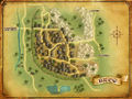 Bree map.jpg 1,024 × 768; 802 KB
-
 Bree POIs map.jpg 917 × 689; 122 KB
-
 Bree-land Artifacts map.jpg 1,024 × 768; 381 KB
-
 Bree-land Homesteads map.jpg 1,024 × 768; 283 KB
-
 Bree-land Homesteads topographic map.png 1,920 × 1,440; 4.54 MB
-
 Bree-land map by Varghedin.jpg 2,400 × 2,000; 7.81 MB
-
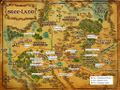
 Bree-land map.jpg 1,024 × 768; 1,004 KB
-
 Bree-land Named Creatures.jpg 1,382 × 1,037; 671 KB
-
 Bree-land POIs.PNG 918 × 688; 1.77 MB
-
 Bree-land Schematic Map.jpg 1,024 × 768; 389 KB
-
 Brigand Cave Map (Chetwood).jpg 256 × 240; 16 KB
-
 Brigand Cave Map (Cirith Nûr Encampment).jpg 201 × 356; 48 KB
-
 Bronwe's Folly Map.jpg 181 × 208; 16 KB
-
 Crumbled Court Map.jpg 187 × 146; 12 KB
-
 Flowers of the Old Forest map.jpeg 856 × 743; 732 KB
-
 Goetham Map.jpg 365 × 359; 61 KB
-
 Great Barrow - Sambrog Map.jpg 972 × 392; 47 KB
-
 Great Barrow - Thadúr Map.jpg 786 × 719; 64 KB
-
 Great Barrow - The Maze Map.jpg 666 × 579; 57 KB
-
 Gwantham Map.jpg 345 × 343; 36 KB
-
 Haudh Iarchith Map (Original).jpg 648 × 293; 32 KB
-
 Haudh Iarchith Map.jpg 562 × 362; 46 KB
-
 Haudh Methernil Map.jpg 480 × 254; 43 KB
-
 Haudh Nogbenn Map.jpg 231 × 343; 36 KB
-
 Haudh Taenthond Map.jpg 274 × 305; 29 KB
-
 Hautham Map.jpg 556 × 471; 52 KB
-
 Hengstacer Course.png 780 × 803; 883 KB
-
 Hillshire Ruins Map.jpg 469 × 294; 51 KB
-
 Marshwater Fort Map.jpg 238 × 406; 28 KB
-
 Midgewater Marsh Map.jpg 1,270 × 1,270; 317 KB
-
 Nen Harn Map.jpg 1,848 × 2,592; 2.28 MB
-
 Northen Barrow-downs Named Creatures and Locations.jpg 1,073 × 803; 1.1 MB
-
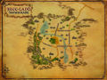
 Northern Barrow-downs map.jpg 1,024 × 768; 955 KB
-
 Northern Barrow-downs Named Creatures.jpg 1,024 × 768; 336 KB
-
 Old Forest explorer deed map.jpg 800 × 600; 288 KB
-
 Old Forest map by Varghedin.jpg 4,383 × 4,701; 7.43 MB
-
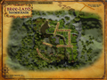
 Old Forest map.jpg 1,024 × 768; 1,019 KB
-
 Old Forest Named Creatures.jpg 800 × 600; 236 KB
-
 Old Forest POI.JPG 917 × 689; 127 KB
-
 Old Greenway Fort Map.jpg 322 × 318; 37 KB
-
 Oldstone Ruins Map.jpg 228 × 218; 26 KB
-
 Ost Barandor Map.jpg 240 × 193; 24 KB
-
 Ost Baranor Map.jpg 358 × 253; 39 KB
-
 Ost Gorthad Overview Map.jpg 257 × 385; 29 KB
-
 South-guard Ruins Map.jpg 415 × 415; 169 KB
-
 Southern Barrow-downs map.jpg 1,024 × 768; 957 KB
-
 Southern Barrow-downs Named Creatures and Locations.jpg 1,070 × 803; 1.09 MB
-
 Southern Barrow-downs Named Creatures.jpg 1,024 × 768; 353 KB
-
 Sprigley's Cellar Map.jpg 728 × 491; 39 KB
-
 The Barrow of Ringdor Map.jpg 609 × 383; 78 KB
-
 The Barrow of Taradan Map.jpg 456 × 335; 43 KB
-
 The Great Barrow - Othrongroth Map.jpg 784 × 660; 70 KB
-
 The Great Barrow Map (Old).jpg 744 × 616; 82 KB
-
 The Great Barrow Map.jpg 1,920 × 1,080; 190 KB
-
 The Prancing Pony (Map).jpg 258 × 421; 15 KB
-
 The Understaddle Map.jpg 565 × 697; 103 KB
-
 Tomb of Maenadar (Inner) Map.jpg 170 × 520; 36 KB
-
 Tomb of Maenadar Map.jpg 159 × 445; 25 KB
-
 Whiteberry Barrow-downs map.jpg 1,120 × 915; 428 KB
-
 Whiteberry Bree-land map.jpg 1,800 × 915; 731 KB
-
 Whiteberry The Old Forest map.jpg 1,800 × 915; 530 KB
-
 Wildwood map.jpg 1,024 × 768; 858 KB
-
 Woe of the Willow map.jpg 700 × 500; 113 KB
-
 Woodsedge Ruins Map.jpg 337 × 221; 22 KB
-
 Writhenset map.jpg 400 × 411; 16 KB
_Map.jpg)


.jpg)
.jpg)


.jpg)


.jpg)

.jpg)


_Map.jpg)