Category:Angmar Maps
Jump to navigation
Jump to search
Maps for Angmar
Media in category "Angmar Maps"
The following 35 files are in this category, out of 35 total.
-
Angmar Artifacts map.jpg 1,024 × 768; 336 KB
-
Angmar map.jpg 1,024 × 768; 658 KB
-
Angmar Named Creatures map.jpg 1,024 × 768; 516 KB
-
Angmar POI.JPG 917 × 687; 172 KB
-
Angmar topographic map.png 1,920 × 1,440; 5.22 MB
-
Angmar Treasure Caches.jpg 1,920 × 1,080; 382 KB
-
Aughaire Terrain map.jpg 740 × 621; 58 KB
-
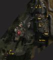
Bail Boglakh (Terrain Map).jpg 1,051 × 727; 74 KB
-
Bail Róva (Terrain Map).jpg 631 × 714; 48 KB
-
Bornabar.JPG 386 × 415; 73 KB
-
Bûrzum Pushdug Map.jpg 203 × 371; 39 KB
-
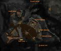
Castellan Obáshurz (overview).jpg 405 × 621; 165 KB
-
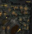
Donnvail (Terrain Map).jpg 500 × 538; 42 KB
-
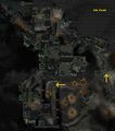
Dûn Covád (Terrain Map).jpg 713 × 806; 81 KB
-
Eithel Úmfaer Terrain Map.jpg 1,013 × 692; 194 KB
-
Ephel Angren map.jpg 1,024 × 768; 840 KB
-
Gwathrenost, the Witch-king's Citadel forgotten tomes.jpg 1,615 × 1,165; 451 KB
-
Gwathrenost, the Witch-king's Citadel map1.jpg 530 × 655; 93 KB
-
Gwathrenost, the Witch-king's Citadel map2.jpg 530 × 655; 83 KB
-
Gwathrenost, the Witch-king's Citadel map3.jpg 530 × 655; 120 KB
-
LowerNoruidor.JPG 388 × 389; 67 KB
-
Morfil Map.jpg 544 × 726; 64 KB
-
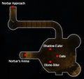
Norbar Approach-map.jpg 505 × 536; 83 KB
-
Norbar Arena.jpg 1,200 × 1,200; 161 KB
-
Norbar.JPG 329 × 306; 42 KB
-
NorbarApproach.JPG 517 × 481; 99 KB
-
Nád Nathair (Map).jpg 556 × 607; 39 KB
-
RhunendinWaves.jpg 500 × 500; 40 KB
-
Thaurisgar braziers.jpg 946 × 612; 185 KB
-
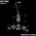
The Halls of Night Map.jpg 727 × 727; 51 KB
-
ThrangShamans.jpg 400 × 300; 50 KB
-
Tór Gailvin (Terrain Map).jpg 527 × 368; 29 KB
-
UdunionStrat.jpg 500 × 500; 65 KB
-
UpperNoruidor.JPG 210 × 388; 45 KB
-
Whiteberry Angmar map.jpg 1,800 × 915; 715 KB


