Category:The Shire Maps
Jump to navigation
Jump to search
Media in category "The Shire Maps"
The following 20 files are in this category, out of 20 total.
-
The Shire Artifacts map.jpg 1,024 × 768; 273 KB
-
Bywater.jpg 269 × 187; 11 KB
-
Bâr Faroth Map.jpg 543 × 408; 64 KB
-
Deephallow.jpg 436 × 434; 59 KB
-
Delving Fields.jpg 300 × 330; 30 KB
-
Elannah Resource Map Prospector Shire.jpg 1,600 × 1,188; 416 KB
-
Far Downs map.png 290 × 211; 176 KB
-
Great Smials (map).jpg 361 × 198; 7 KB
-
Greenfields Warren Map.jpg 310 × 600; 34 KB
-
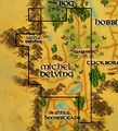
Michel Delving Map.jpg 427 × 521; 45 KB
-
Scarry Quarry.jpg 567 × 263; 36 KB
-
The Shire Yondershire map.jpg 1,530 × 1,119; 1.68 MB
-
Shire Homesteads map.jpg 1,024 × 768; 1.11 MB
-
Shire Homesteads topographic map.png 1,920 × 1,440; 4.75 MB
-
Shire map Explorer deeds.jpg 1,024 × 768; 537 KB
-
Shire map.jpg 1,024 × 768; 968 KB
-
Shire Named Creatures.jpg 1,024 × 768; 428 KB
-
Shire-points of interest.jpg 1,024 × 768; 361 KB
-
Southfarthing of the Shire map.png 349 × 256; 267 KB
-
Yondershire map.jpg 1,024 × 768; 934 KB


