File:Plas-maru Map.jpg
Jump to navigation
Jump to search
Size of this preview: 800 × 486 pixels. Other resolution: 888 × 540 pixels.
Original file (888 × 540 pixels, file size: 73 KB, MIME type: image/jpeg)
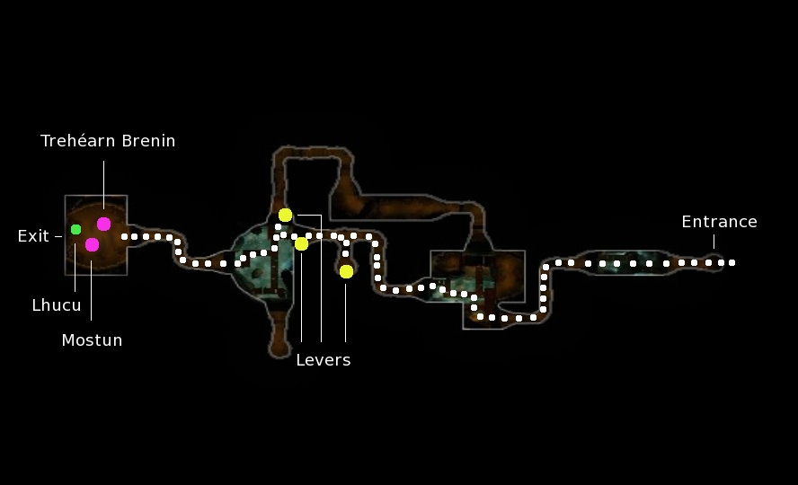
Map of Plas-maru. The yellow dots indicate the locations of the closest levers. The pink dots indicate the location of Mostun and Trehéarn Brenin. The white dots show the fastest route to complete the instance.
File history
Click on a date/time to view the file as it appeared at that time.
| Date/Time | Thumbnail | Dimensions | User | Comment | |
|---|---|---|---|---|---|
| current | 11:55, 28 October 2011 | | 888 × 540 (73 KB) | Ravanel (talk | contribs) | Version with more information. |
| 10:28, 3 October 2011 |  | 894 × 561 (81 KB) | Ravanel (talk | contribs) | Category:Interior Maps Category:Dunland Maps Trehéarn and Mostun are found in the uttermost west. |
You cannot overwrite this file.
File usage
The following 2 pages use this file: