File:Middle-Earth topographic map.png
Jump to navigation
Jump to search
Size of this preview: 800 × 600 pixels. Other resolution: 2,400 × 1,800 pixels.
Original file (2,400 × 1,800 pixels, file size: 7.71 MB, MIME type: image/png)
Summary
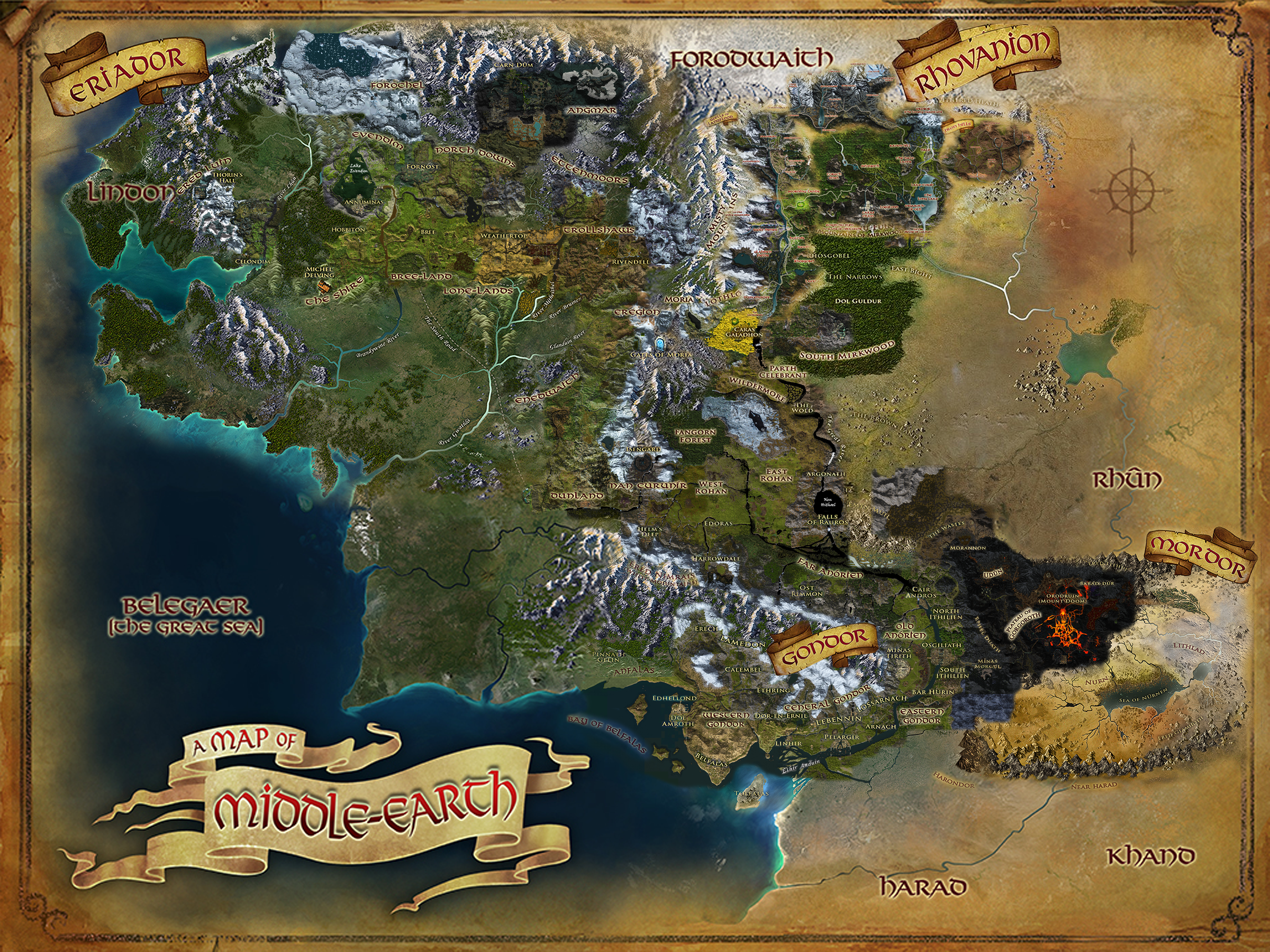
A composite map of Middle-Earth by User:Varghedin based on the in-game world and land maps, as well as topographic maps of each region from https://lotromap.net/.
File history
Click on a date/time to view the file as it appeared at that time.
| Date/Time | Thumbnail | Dimensions | User | Comment | |
|---|---|---|---|---|---|
| current | 14:27, 3 May 2020 | | 2,400 × 1,800 (7.71 MB) | Varghedin (talk | contribs) | Updated with Wells of Langflood |
| 19:31, 6 June 2019 | 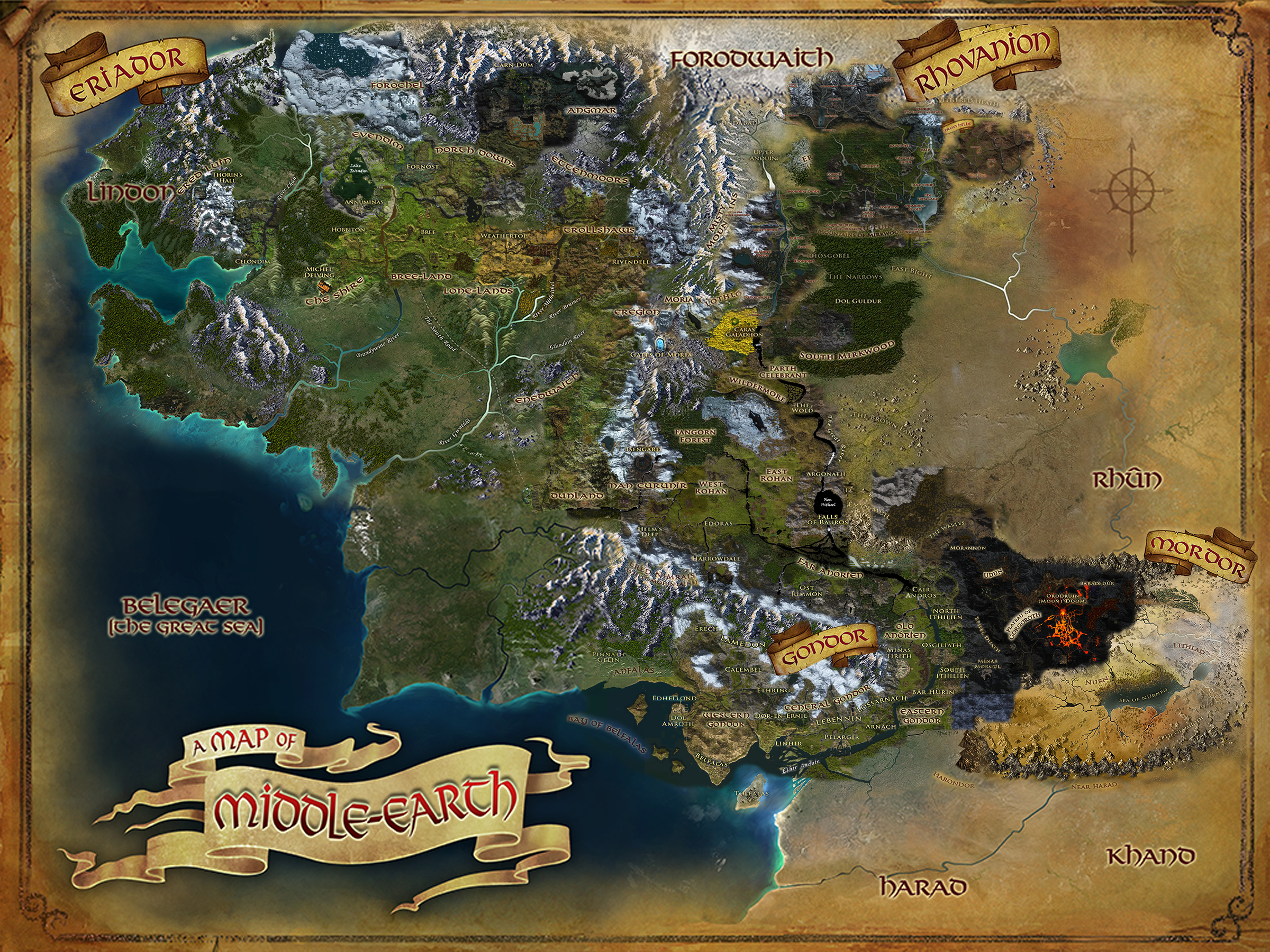 | 2,400 × 1,800 (7.64 MB) | Varghedin (talk | contribs) | Adjusted banner | |
| 19:27, 6 June 2019 |  | 2,400 × 1,800 (7.65 MB) | Varghedin (talk | contribs) | Updated with Northern Rhovanion | |
| 19:53, 22 May 2019 | 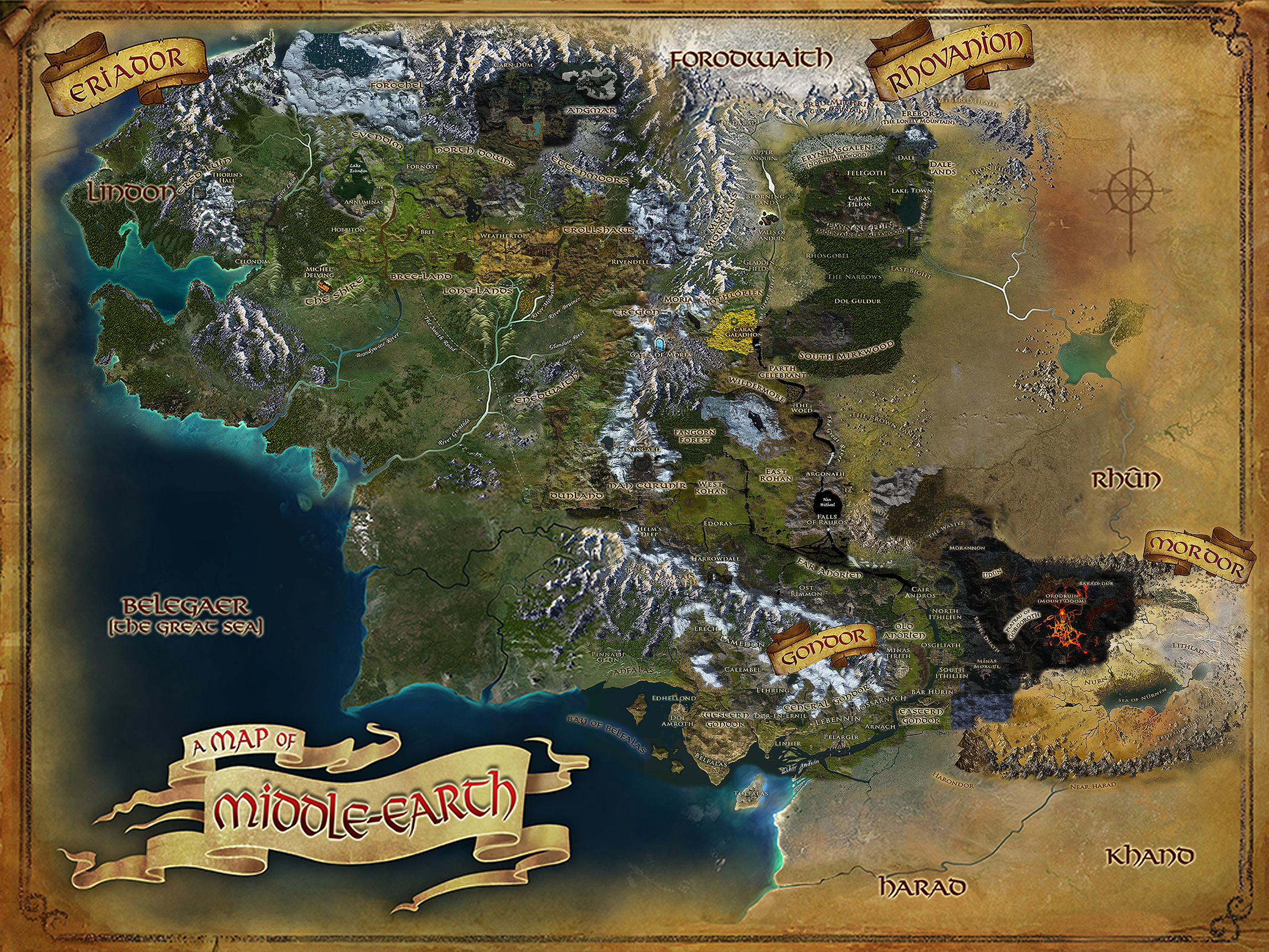 | 2,300 × 1,725 (7.96 MB) | Varghedin (talk | contribs) | A composite map of Middle-Earth by User:Varghedin based on the in-game world and land maps, as well as topographic maps of each region from http://lotromap.net/. Category: Region Maps Category: Topographic Maps |
You cannot overwrite this file.
File usage
The following 2 pages use this file: